|
|
|
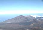
HALEAKALA NATIONAL PARK, HAWAII |
|
|
Photographic
Archive 1987-1995 |
|
|
|
|
SPECTRUM FREQUENCY SUMMARIES
Visual
range (km) and cumulative frequency summaries are provided for each archived
spectrum series with associated IMPROVE aerosol data. Aerosol data correlations
are not available for sites having no associated aerosol data prior to Fall
1999.
Tabular summaries
for each range of visibility grouping include:
- Spectrum sequence number
- The representative
visibility condition for each archived image. Units presented include:
- deciview(dv)- the haziness
index designed to be linear with respect to human perception of
visibility. A 1-2 dv change in haziness corresponds to a small, visibly
perceptible change in scene appearance. Higher deciview values indicate
more extinction and a corresponding decrease in visual range, indicating
an increase in haziness.
- extinction (bext)
- the loss of light due to scattering and absorption as it passes through
a medium. Presented in units of inverse megameters (Mm-1),
with 10 representing pristine conditions.
- visual range (VR) - the
distance at which a large black object just disappears from view.
Presented in kilometers, with 391 representing pristine (Rayleigh)
conditions.
- The frequency of
occurrence of the given image's visibility condition in relation to IMPROVE
aerosol data collected at the site.
Word of Caution:
No direct correlation should be made between original visibility
monitoring slides (or their measurements) and these provided reproduced images.
Each replication and measured slide contrast is different from the original
Kodachrome 35mm slide because of changes in film exposure, film type, digital
scanning calibrations, and viewing equipment. Slides should be grouped into
visibility categories such as excellent, good, medium, and poor. All associated
photographs were selected as a set and must remain intact.
It should be noted
that there is error, sometimes substantial error, in the process of estimating
visual range from Kodachrome slides. True error in each slide measurement is
dependent on the characteristics of the scene and target, weather conditions,
sun angle, uniformity of the air quality in the sight path, film exposure,
measurement error and other factors. The above visual range estimates and
corresponding extinction and deciview measurements have been rounded for
precision.